Last updated: 2026-07-23
14 — Height separates: 3D traffic and the digital sky
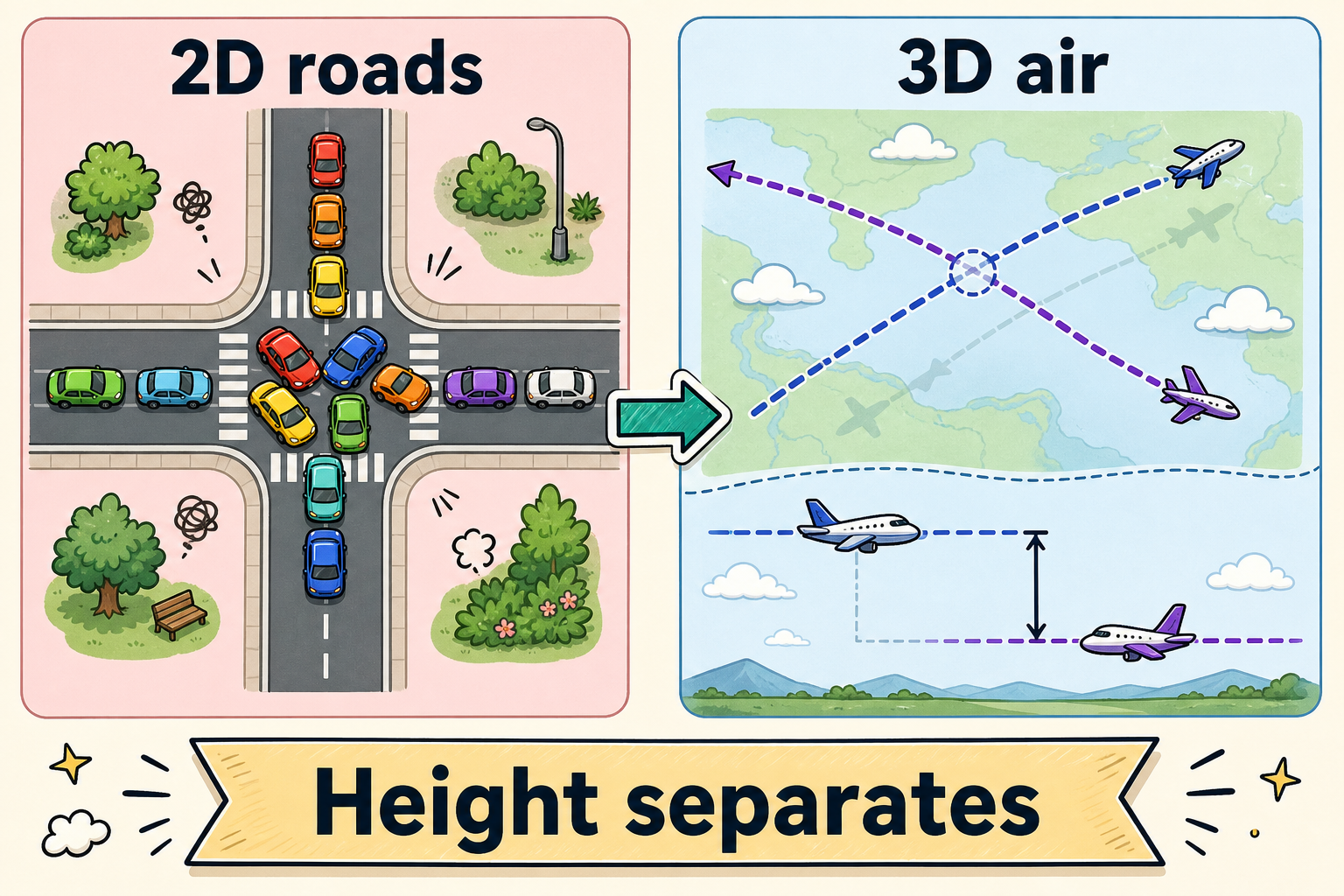
Two lines drawn on a flat pane, if they are not parallel, must meet. That is not a traffic engineer’s opinion. It is geometry. Cities turn those forced meetings into intersections, lights, horns, and lost afternoons. Call it congestion if you like. The deeper name is dimension.
Roads are mostly a two-dimensional bargain. Pavement is a shared plane. When your path and mine want the same patch of asphalt at the same time, one of us waits. Parallel lanes buy a little relief. They do not repeal the rule.
Now lift the trip off the ground.
Aircraft paths are curves in three-dimensional space. Two vehicles can share the same pin on a map—same street corner if you look only from above—and still miss, because one is eighty meters up and the other is one hundred twenty. Height, and time, become lanes that roads almost never had. Drones and flying taxis do not magically erase traffic. They move conflict out of the forced planar meeting and into a problem of volumes.
That is the honest half of every “skip the jam, take the sky” pitch.
The dishonest half pretends volumes manage themselves.
They do not. Same place, same height, same minute is still a crash. Landing pads and vertiports squeeze freedom back into funnels. Noise rules draw corridors that look suspiciously like highways drawn in air. Weather flattens the useful slice of sky into a thinner sandwich. The geometry gift is real. The gift requires air traffic management for a density classical controllers cannot voice-vector.
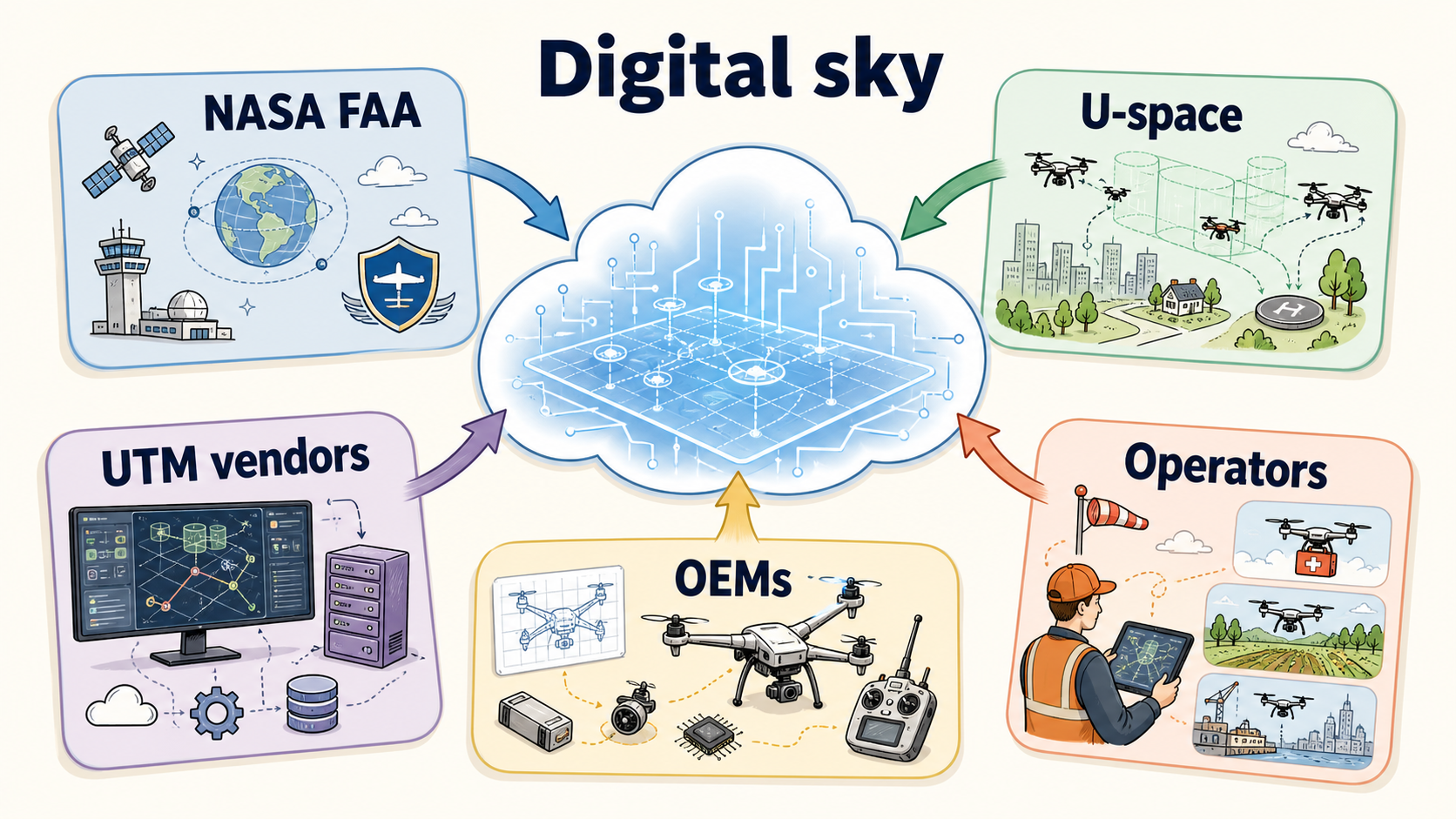
Enter UTM—UAS Traffic Management, also called uncrewed traffic management. Think less of a tower full of headsets and more of a digital bargain: operators publish flight intent; service providers deconflict plans; regulators and air navigation services set constraints; software tracks who is where and shouts when someone leaves the script. NASA and the FAA spent years defining the U.S. concept. Europe built a regulatory cousin called U-space, with certified U-space Service Providers under rules that entered force in 2021. ICAO publishes frameworks so nations do not invent seventeen incompatible skys.
Who actually builds pieces of that plumbing?
Public spine: NASA’s UTM research, the FAA’s maturation path (including LOAs for service suppliers and the limited but real LAANC digital authorizations near airports), EASA’s U-space regime, national air navigation service providers testing designated low-altitude volumes.
Commercial vendors: companies such as ANRA Technologies, Airspace Link, and a rotating cast of UTM startups sell operator-facing software—planning, authorization, tracking. Large ATM suppliers—Thales, Airbus, Indra—extend traditional air traffic products downward. The UK’s Altitude Angel (GuardianUTM) was a flagship brand until financial distress; industry reports in late 2025 put it into administration, and Indra announced acquisition of GuardianUTM assets in January 2026. Markets consolidate. The need does not vanish when a logo does.
Network dreamers and OEMs: In 2016, Uber published the Elevate white paper—on-demand urban air rides, skyports sited with rideshare data, multimodal trips rather than garage science fiction. Summits followed. Uber even ran helicopter experiments under the Uber Copter brand as a demand probe. In 2020, Joby Aviation acquired Uber Elevate. The airframe company inherited network DNA: the hard product is not only wings and batteries, but the operating system that sequences trips through a city without turning the sky into a free-for-all.
Delivery giants and OEMs still run private stacks. The long game is federation—private apps that can share intent at the boundary so two brands do not invent a midair the hard way.
Corridors and altitude bands will return even in a 3D world, because humans need predictability, emergency services need mental models, and neighbors need quieter slices of night. Structure is not a betrayal of the geometry lesson. It is how cities spend the extra dimension without chaos.
So when someone says drones will end traffic jams, answer with two sentences.
In a plane, non-parallel paths meet—that is why intersections exist.
In the air, height can separate map-crossing paths—but only if intent is shared, volumes are reserved, and the digital sky is real.
Uber named the network. Regulators named the public architecture. Vendors and ANSPs pour the concrete of APIs. Until those mature, the third dimension is a promise with a paperwork problem—and the jam is still waiting on the ground for anyone who lands.